
Introduction
A platform for urban planning visualization and community engagement.
What is Laneform?
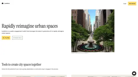
Laneform is a platform for urban planners, developers, and public leaders to create concept images and guide community members through interactive visual investigations.
How to use Laneform?
City planners, developers, and public leaders use Laneform to create visual representations of city plans and then engage with community members through interactive visual surveys to gather feedback and support.
Laneform’s core features
Concept image creation for urban planning
Interactive visual surveys for community engagement
Interactive visual surveys for community engagement
Visits:6
Updated:2026-11-06





1
 2
 3
 4
 5
 6
 7
 8
 9
 10

Tangle.io
Intelligent ERP software for the manufacturing industry, quickly deployed to meet unique needs.
Docsumo
Docsumo 自动从非结构化文档中提取数据,准确率高且效率高。
WorkWeave
增强工程团队性能的 AI 平台,提供个性化见解。
My Dream Team
人工智能平台,用于创建并与虚拟梦想专家团队聊天。
GradeLab
An AI-powered grading and assessment platform for educators.
AI Product Tools
AI-based tool for generating descriptions, titles, and tags for e-commerce products.
CalcGen AI
An AI-powered platform for creating interactive charts, graphs, calculators, and data visualizations.
Aginsi AI
Aginsi is an AI research tool for collecting, summarizing, and organizing research.
Internet.io
一个将顶级AI引擎整合为可靠洞察和自定义代理创建的平台。
VoiceInk
An open-source speech-to-text app for macOS that provides local AI to protect privacy and support offline use.
1
 2
 3
 4
 5
 6
 7
 8
 9
 10

Zlibrary
Zlibrary is known as the world's largest digital library, containing 9,826,996 e-books and 84,837,646 journal articles. From various well-known literary works, science and engineering, humanities and arts, to academic papers, etc.! Support PDF, epu
LinkFox AI
为跨境电商提供的AI工具
HeyGen
AI数字人视频生成
堆友AI
堆友是Alibaba Design打造的设计师全成长周期服务平台,围绕品质、效率、技能、成就、收入五大用户价值布局平台能力,全力服务设计师,旨在成为设计师的好朋友。
堆友历经大厂设计师团队多轮打磨雕刻,集海量高品质3D素材、实时在线渲染、多元场景功能应用、轻便好学易上手等多重优势于一身的设计神器,更自带免费可商用属性,为专业设计师、运营工友、学生小白、社交达人提供了一个零成本的在线设计站点和资源库。
PixPix
AI电商套图与视频生成
OptimizerAI
AI音效生成器,基于文本或音频生成无限高质量声音。
Riffusion
生成式AI乐器,能够根据文本提示创建、重混和分享高品质歌曲。
StockTune
StockTune provides AI-generated royalty-free music for content creators to use without attribution.
PDF Converter
Free online tool for converting and editing PDF files.
高性价比人生指南HowToLiveBetter
手机里还有哪些会员在自动扣费?常用邮箱的密码,有没有和其他网站重复?租房合同里,押金到底什么时候退? 这些事单独拿出来,都不算复杂。但没人提醒的时候,很容易踩坑。今天分享一个 GitHub 60.5k
1
2
3
4
5
6
7
8
9
10
Zlibrary
Zlibrary is known as the world's largest digital library, containing 9,826,996 e-books and 84,837,646 journal articles. From various well-known literary works, science and engineering, humanities and arts, to academic papers, etc.! Support PDF, epu
LinkFox AI
为跨境电商提供的AI工具
HeyGen
AI数字人视频生成
堆友AI
堆友是Alibaba Design打造的设计师全成长周期服务平台,围绕品质、效率、技能、成就、收入五大用户价值布局平台能力,全力服务设计师,旨在成为设计师的好朋友。
堆友历经大厂设计师团队多轮打磨雕刻,集海量高品质3D素材、实时在线渲染、多元场景功能应用、轻便好学易上手等多重优势于一身的设计神器,更自带免费可商用属性,为专业设计师、运营工友、学生小白、社交达人提供了一个零成本的在线设计站点和资源库。
PixPix
AI电商套图与视频生成
OptimizerAI
AI音效生成器,基于文本或音频生成无限高质量声音。
Riffusion
生成式AI乐器,能够根据文本提示创建、重混和分享高品质歌曲。
StockTune
StockTune provides AI-generated royalty-free music for content creators to use without attribution.
PDF Converter
Free online tool for converting and editing PDF files.
高性价比人生指南HowToLiveBetter
手机里还有哪些会员在自动扣费?常用邮箱的密码,有没有和其他网站重复?租房合同里,押金到底什么时候退? 这些事单独拿出来,都不算复杂。但没人提醒的时候,很容易踩坑。今天分享一个 GitHub 60.5k